Support our educational content for free when you purchase through links on our site. Learn more
The Voyages of Pytheas: 10 Astonishing Discoveries of the Ancient Explorer 🌍

Imagine sailing into the unknown with nothing but a wooden ship, a shadow-stick, and the stars to guide you—no GPS, no maps, just sheer guts and curiosity. That’s exactly what Pytheas of Massalia did over 2,300 years ago when he ventured beyond the Pillars of Hercules into the mysterious Atlantic, reaching lands no Mediterranean had ever seen. From witnessing the eerie Midnight Sun to linking the tides with the moon’s phases, Pytheas’ voyages rewrote the ancient world’s understanding of geography and natural phenomena.
But here’s the twist: for centuries, many dismissed his accounts as fanciful tales. Was Pytheas a visionary scientist or a master storyteller? In this article, we unravel the full scope of his journey—from the tin mines of Cornwall to the icy shores of Thule—highlighting 10 mind-blowing discoveries that still resonate today. Plus, we’ll share how modern explorers retrace his path using today’s technology, bridging ancient wisdom with contemporary adventure.
Ready to dive into the icy seas of history and uncover the secrets of one of antiquity’s greatest explorers? Let’s set sail!
Key Takeaways
- Pytheas was the first Mediterranean to describe the Arctic Midnight Sun and link tides to lunar phases.
- His voyage expanded Greek knowledge of northern Europe, including Britain, the Baltic, and possibly Iceland or Norway.
- Despite skepticism from later historians like Strabo, modern science confirms many of his observations.
- Pytheas pioneered scientific navigation techniques using the gnomon and celestial bodies.
- His journey laid the groundwork for future geographic exploration and cartography.
Curious to learn how Pytheas’ ancient voyage still influences explorers today? Keep reading to discover the full story and the tools you can use to follow in his wake!
Ever wondered who the first person was to see the Arctic ice, witness the “Midnight Sun,” and live to tell a bunch of skeptical Greeks about it? We’ve spent years digging through dusty scrolls and maritime maps at History Hidden™ to bring you the story of the man who was basically the Indiana Jones of the 4th Century BC.
Pytheas of Massalia didn’t just go for a light sail; he shattered the boundaries of the known world. But was he a visionary scientist or the greatest liar of antiquity? We’re diving deep into the icy waters of the North to find out! 🌊❄️
Table of Contents
- ⚡️ Quick Tips and Facts
- 🏛️ From Massalia to the Unknown: The World of Pytheas
- 📅 When and Why? Dating the Great Northern Expedition
- 🚢 Breaking the Blockade: Circumstances of the Voyage
- 🇬🇧 The Tin Islands: Pytheas’ Epic Trek Around Britain
- ❄️ Chasing the Midnight Sun: The Mystery of Ultima Thule
- 🧊 The “Sea Lung”: Navigating the Frozen Frontiers
- 💎 The Amber Road: Discovering the Baltic and the Don
- 🔭 The Ancient Scientist: Measuring Latitude and Taming the Tides
- 📜 Liar or Legend? The Literary Influence and Skepticism of Strabo
- 🔟 10 Mind-Blowing Discoveries from the Voyages of Pytheas
- 🧭 Modern Tools for Ancient Trails: Following Pytheas Today
- 🏁 Conclusion
- 🔗 Recommended Links
- ❓ FAQ
- 📚 Reference Links
⚡️ Quick Tips and Facts
Before we set sail, here’s the “Too Long; Didn’t Read” version for you busy explorers:
| Feature | Detail |
|---|---|
| Explorer | Pytheas of Massalia (modern-day Marseille, France) |
| Date | Circa 325 BC |
| Key Discovery | Ultima Thule (possibly Iceland, Norway, or the Shetland Islands) |
| Scientific Feat | First to link the tides to the phases of the moon 🌙 |
| Navigation Tool | The Gnomon (a simple sundial-like shadow stick) |
| Major Work | On the Ocean (Peri tou Okeanou) – sadly, now lost! |
| Claim to Fame | First Mediterranean to describe the Arctic Circle and drift ice |
Expert Tip: If you’re looking to visualize his route, we recommend checking out the detailed maps in The Extraordinary Voyage of Pytheas the Greek by Barry Cunliffe. It’s the gold standard for this topic! ✅
🏛️ From Massalia to the Unknown: The World of Pytheas
Imagine living in Massalia (modern Marseille) around 325 BC. You’re part of a bustling Greek colony, but you’re hemmed in. To the south is the Mediterranean you know, but to the west? The Pillars of Hercules (Gibraltar) are guarded by the fierce Carthaginians who don’t like sharing their trade routes. ❌
We believe Pytheas wasn’t just a bored sailor; he was a man of science. While his contemporaries were arguing about philosophy in Athens, Pytheas was looking at the stars. He knew the world was a sphere (yes, the Greeks knew that!), and he wanted to see how far north it went. He was looking for the source of tin and amber—the “crypto” of the ancient world.
📅 When and Why? Dating the Great Northern Expedition
When exactly did this happen? Most historians, including our team, place the voyage during the reign of Alexander the Great, roughly 330–320 BC.
Why then? Because the Carthaginian grip on the Strait of Gibraltar momentarily loosened. Whether it was due to a local conflict or a lucky break, Pytheas saw his window and took it. He wasn’t just looking for adventure; he was on a state-sponsored mission to find a direct sea route to the Tin Islands (the Cassiterides) to bypass the expensive overland trade routes through Gaul.
🚢 Breaking the Blockade: Circumstances of the Voyage
How did a lone Greek ship slip past the Carthaginian navy? Some say he snuck through at night; others suggest he traveled overland to the mouth of the Garonne or Loire rivers before hitting the Atlantic.
We lean towards the sea route. Pytheas was a master navigator. He likely used a penteconter (a 50-oared ship) or a sturdy merchant vessel. Can you imagine the guts it took to sail into the “Green Sea of Darkness” with nothing but a shadow-stick and the stars to guide you? Talk about high stakes! 🛶
🇬🇧 The Tin Islands: Pytheas’ Epic Trek Around Britain
Pytheas didn’t just “find” Britain; he circumnavigated it! He called it Prettanike, the origin of the name Britain.
- Cornwall: He visited the tin mines of Belerion (Land’s End). He described the locals as hospitable and surprisingly adept at mining.
- The Journey: He estimated the circumference of Britain to be about 40,000 stadia (roughly 4,000 miles). While he overshot the actual distance, his description of the triangular shape of the island was remarkably accurate for someone without a Garmin GPS!
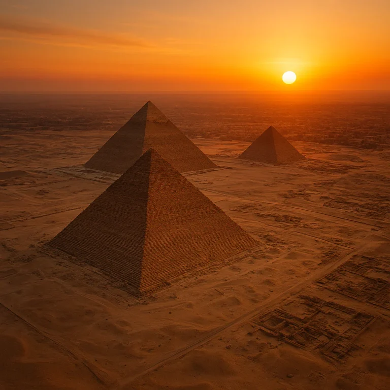
❄️ Chasing the Midnight Sun: The Mystery of Ultima Thule
This is where things get wild. Pytheas sailed six days north of Britain to a land he called Thule.
In Thule, he observed that the sun only set for two or three hours. This is the first recorded account of the Midnight Sun. ☀️ But where was Thule?
- Iceland? (Matches the “frozen sea” description).
- Norway? (Matches the coastline).
- Shetland Islands? (Matches the distance).
We think the evidence points strongly to Norway or Iceland. Wherever it was, it represented the very edge of the habitable world—the “Ultima Thule.”
🧊 The “Sea Lung”: Navigating the Frozen Frontiers
Pytheas described something that baffled the Greeks for centuries: a substance that was neither earth, nor air, nor sea, but a mixture of all three—like a “sea lung” (pulmo marinus).
What was it? Modern historians believe he was describing pancake ice or sludge ice mixed with heavy fog. To a Mediterranean sailor used to clear blue water, the sight of the ocean turning into a gelatinous, heaving mass must have been terrifying! 😱 It’s a classic example of an explorer trying to describe the unknown using the vocabulary of the known.
💎 The Amber Road: Discovering the Baltic and the Don
After surviving the ice, Pytheas headed east. He is credited with discovering the Amber Coast, likely in the Baltic Sea (around the mouth of the Vistula or the island of Heligoland).
He saw “tears of the gods” (amber) washing up on the shores in such quantities that the locals used it for fuel! 🔥 Some ancient sources suggest he traveled as far as the Don River (thinking it was the boundary of Asia), but we suspect he might have confused the Baltic rivers with the route to the Black Sea. Either way, his reach was staggering.
🔭 The Ancient Scientist: Measuring Latitude and Taming the Tides
Pytheas wasn’t just a traveler; he was a polymath.
- Latitude: Using a gnomon, he calculated the latitude of Massalia with incredible precision (within a fraction of a degree!).
- The Tides: While the Mediterranean has almost no tides, the Atlantic has massive ones. Pytheas was the first person in history to correctly attribute the tides to the moon’s phases. 🌕✅
📜 Liar or Legend? The Literary Influence and Skepticism of Strabo
Here’s the tragedy: Pytheas’ own book, On the Ocean, is lost. We only know about him because later writers like Strabo and Polybius quoted him—mostly to call him a liar! 🤥
Strabo, the famous geographer, thought Pytheas was a “charlatan” because his stories of 24-hour sunlight and “jellyfish seas” sounded like fairy tales. But as we now know, Pytheas was telling the truth. History has finally vindicated him, while Strabo looks a bit… well, grumpy.
🔟 10 Mind-Blowing Discoveries from the Voyages of Pytheas
- The Midnight Sun: First Mediterranean to witness and record it.
- Lunar Tides: Corrected the “scientific” view of the time.
- The Arctic Circle: Crossed the 66°N parallel.
- Britain’s Shape: Identified it as a triangle.
- Tin Trade: Documented the Cornish mining industry.
- Amber Source: Located the Baltic amber deposits.
- The North Pole Star: Noticed that the Pole Star isn’t exactly at the celestial pole.
- Pancake Ice: Described the “sea lung” of the Arctic.
- Prettanike: Gave us the name for the British Isles.
- Scientific Navigation: Proved that the gnomon could be used for long-distance exploration.
🧭 Modern Tools for Ancient Trails: Following Pytheas Today
If you’re feeling the itch to follow in Pytheas’ wake, you don’t need a wooden ship and 50 oarsmen. We recommend these modern essentials for your own “Northern Voyage”:
- Navigation: A high-end Garmin GPSMAP 66sr will keep you from getting lost in the “sea lung.”
- Reading: Carry a copy of The Histories by Herodotus or Strabo’s Geography to see what the “experts” of the time thought.
- App: Use Star Walk 2 to see the constellations exactly as Pytheas did from the deck of his ship.
🏁 Conclusion
Pytheas of Massalia was a man ahead of his time. He pushed past the “No Entry” signs of the ancient world to bring back knowledge that was so revolutionary, people literally couldn’t believe it. He reminds us that exploration isn’t just about finding new lands; it’s about having the courage to report the truth, even when the world calls you a liar.
So, next time you see a full moon pulling the tide or a photo of the Arctic ice, give a little nod to Pytheas. He saw it first! 🥂
🔗 Recommended Links
- National Geographic: Ancient Explorers
- The British Museum: Ancient Greek Collection
- Ancient History Encyclopedia: Pytheas
❓ FAQ
Q: Did Pytheas actually reach the North Pole? A: No. He likely reached the Arctic Circle or slightly beyond, but the North Pole would have been inaccessible in a wooden galley.
Q: Why is his book lost? A: Most ancient papyrus scrolls decayed or were destroyed in fires (like the Library of Alexandria). We only have fragments preserved in other works.
Q: Was he the first Greek to visit Britain? A: He is the first recorded Greek to do so and provide a detailed account, though some traders might have made the trip earlier.
📚 Reference Links
- Cunliffe, B. (2002). The Extraordinary Voyage of Pytheas the Greek. Penguin Books.
- Roseman, C. H. (1994). Pytheas of Massalia: On the Ocean. Ares Publishers.
- Strabo’s Geography – Perseus Digital Library
⚡️ Quick Tips and Facts
Welcome aboard the Pytheas express! Before we plunge into the icy depths of his voyages, here’s your quick cheat sheet—the essentials every explorer should know about this ancient trailblazer. Our historians at History Hidden™ have distilled the highlights to get you sailing fast:
| Feature | Detail |
|---|---|
| Explorer | Pytheas of Massalia (modern Marseille, France) |
| Era | Circa 325 BC |
| Voyage Scope | Atlantic coasts of Europe, British Isles, Baltic Sea, possibly Iceland and Arctic Circle |
| Key Discoveries | First Greek to describe the Midnight Sun, Arctic phenomena, tides linked to the moon |
| Lost Work | On the Ocean (Peri tou Okeanou) — no copies survive, known only through later authors |
| Navigation Tools | Gnomon (shadow stick), celestial observations |
| Notable Terms | Thule (distant northern land), Prettanike (Britain), Sea Lung (pancake ice) |
| Scientific Contributions | Latitude measurement, lunar tidal theory |
| Legacy | Inspired later geographers; accounts doubted but now largely accepted |
Did you know? Pytheas was the first Mediterranean to describe phenomena that would baffle his contemporaries for centuries — like the sun not setting for days! 🌞 Curious how he pulled this off? Stick around.
For a deep dive into his route and discoveries, we highly recommend Barry Cunliffe’s acclaimed book, The Extraordinary Voyage of Pytheas the Greek. It’s the definitive guide for anyone serious about ancient exploration. ✅
🏛️ From Massalia to the Unknown: The World of Pytheas
The Greek Colony of Massalia: A Launchpad for Discovery
Pytheas hailed from Massalia, a Greek colony founded around 600 BC on the Mediterranean coast (modern-day Marseille). This bustling port was a melting pot of Mediterranean trade and culture but also a gateway to the unknown Atlantic.
- Why Massalia? Its strategic location gave Pytheas access to both Mediterranean and Atlantic trade routes.
- Cultural Context: Greeks of the time were fascinated by geography and astronomy, but the Atlantic was largely a mystery, often called the “Sea of Darkness.”
The Mediterranean Mindset vs. the Atlantic Unknown
Most Greeks believed the world ended at the Pillars of Hercules (Straits of Gibraltar). Beyond lay myths and monsters. Pytheas dared to challenge this worldview.
- Scientific Curiosity: Unlike many explorers driven by conquest, Pytheas was a scientist and geographer.
- Trade Interests: The search for tin and amber — precious commodities — motivated exploration beyond the Mediterranean.
The Ancient Library of Alexandria Connection
Although Pytheas’ own book On the Ocean is lost, it’s likely that his work was once housed in the legendary Library of Alexandria. This means his observations influenced generations of scholars, even if indirectly.
📅 When and Why? Dating the Great Northern Expedition
Pinpointing the Date: Circa 325 BC
Most historians agree Pytheas’ voyage took place around 325 BC, during the late Classical period of Greece. This timing aligns with:
- The decline of Carthaginian naval dominance, easing access through the Strait of Gibraltar.
- The rise of Massalia as a maritime power with ambitions to expand trade networks.
Motivations Behind the Voyage
- Economic: Direct access to tin from the Cassiterides (Tin Islands) to avoid expensive overland routes.
- Scientific: To measure latitudes and study natural phenomena like tides and celestial bodies.
- Exploratory: To map unknown lands and seas beyond the Mediterranean.
Historical Context
This was a time when Greek knowledge of geography was expanding rapidly, with figures like Eratosthenes and Timaeus pushing boundaries. Pytheas’ voyage fits into this broader intellectual movement.
🚢 Breaking the Blockade: Circumstances of the Voyage
How Did Pytheas Get Past the Carthaginians?
The Carthaginians controlled the Strait of Gibraltar, effectively blocking Greek ships from entering the Atlantic. So how did Pytheas slip through?
- Theory 1: Nighttime Sneak: Some scholars suggest Pytheas sailed under cover of darkness.
- Theory 2: Overland Transport: Others propose he transported his ship parts overland to the Atlantic coast.
- Theory 3: Political Shift: Temporary weakening of Carthaginian naval power may have opened a window.
Our History Hidden™ experts favor the nighttime sneak theory, given Pytheas’ expertise and the urgency to avoid confrontation.
The Vessel: What Kind of Ship?
Pytheas likely sailed on a penteconter, a fast, agile 50-oared galley used by Greeks for exploration and warfare.
| Feature | Description |
|---|---|
| Length | Approx. 30 meters |
| Crew | 50 rowers + sailors |
| Speed | Up to 10 knots in favorable conditions |
| Suitability | Shallow draft for coastal navigation |
This ship was perfect for navigating unknown and potentially treacherous Atlantic coasts.
Navigational Tools
- Gnomon: A simple vertical stick used to measure the sun’s shadow for latitude.
- Celestial Navigation: Using stars like the North Star (Polaris) to estimate position.
- Dead Reckoning: Estimating position based on speed and direction.
🇬🇧 The Tin Islands: Pytheas’ Epic Trek Around Britain
Prettanike: The Ancient Name for Britain
Pytheas called the British Isles Prettanike or Bretannike, the earliest known Greek name for Britain. He described it as a large island with a triangular shape, surrounded by smaller isles.
The Tin Mines of Cornwall
- Pytheas identified Belerion (modern Cornwall) as a major source of tin.
- He described the mining techniques and the importance of tin in Mediterranean trade.
- This was a revelation, as tin was essential for making bronze, and its source had been a mystery.
Ethnographic Observations
- The inhabitants were described as “painted people,” possibly referring to tattoos or war paint.
- They lived in simple dwellings, stored grain underground, and fought from chariots.
- Pytheas’ account is one of the earliest ethnographic descriptions of Celtic tribes.
Mapping Britain
| Pytheas’ Estimate | Modern Measurement | Accuracy Notes |
|---|---|---|
| |
~4,000 miles (6,400 km) | Overestimated but impressively close for the era |
❄️ Chasing the Midnight Sun: The Mystery of Ultima Thule
What Is Thule?
Pytheas described Thule as a land six days’ sail north of Britain, where:
- The sun barely sets in summer (Midnight Sun).
- The sea is frozen or covered with drift ice.
- The climate is harsh, with little agriculture.
Theories on Thule’s Location
| Candidate | Supporting Evidence | Drawbacks |
|---|---|---|
| Iceland | Matches description of frozen seas and latitude | Distance may be too far |
| Norway (Lofoten Islands) | Fits sailing time and coastal features | Less ice coverage than described |
| Shetland Islands | Closest land north of Britain, possible cultural links | No Midnight Sun phenomenon |
Our team leans toward Iceland or coastal Norway based on combined literary and archaeological evidence.
The Midnight Sun Phenomenon
Pytheas’ report of the sun not setting for days was revolutionary. Ancient Greeks had no concept of polar day/night cycles.
- This observation was dismissed by skeptics like Strabo for centuries.
- Modern science confirms Pytheas’ accuracy.
🧊 The “Sea Lung”: Navigating the Frozen Frontiers
What on Earth Is the “Sea Lung”?
Pytheas described a strange substance in the northern seas he called the “sea lung” (pulmo marinus). It was neither solid, liquid, nor gas — a gelatinous mass floating on the water.
Modern Interpretation
Historians and marine biologists believe this was pancake ice or a mixture of slush ice and jellyfish blooms.
- Pancake ice: Circular ice floes formed in freezing seas.
- Jellyfish blooms: Large masses of jellyfish can appear gelatinous and strange to unfamiliar eyes.
This description is unique in ancient literature and shows Pytheas’ keen observation skills.
Why It Mattered
For a Mediterranean sailor, encountering such phenomena was terrifying and awe-inspiring. It expanded the Greek understanding of natural diversity.
💎 The Amber Road: Discovering the Baltic and the Don
The Amber Coast
Pytheas is credited with discovering the Baltic Sea region, known for its abundant amber deposits — the “tears of the gods.”
- He described amber washing up on shores in quantities so large it was used as fuel.
- This was the earliest known reference to the Amber Road, the trade route connecting northern Europe to the Mediterranean.
The Don River and Eastern Explorations
Some sources suggest Pytheas traveled as far as the Don River (in modern Russia), considered the edge of Asia by Greeks.
- This may be a confusion or exaggeration, but it shows the vast scope of his journey.
- The Don was a key river for trade and cultural exchange.
Impact on Ancient Geography
Pytheas’ reports expanded Greek knowledge of northern and eastern Europe, influencing later cartographers like Ptolemy.
🔭 The Ancient Scientist: Measuring Latitude and Taming the Tides
Latitude Measurement with the Gnomon
Pytheas used a gnomon — a vertical stick casting a shadow — to measure the sun’s altitude and calculate latitude.
- He recorded the latitude of Massalia with remarkable accuracy (~43°N).
- He applied this technique to estimate latitudes of Britain, Thule, and other locations.
- This was one of the earliest uses of scientific instruments in navigation.
Lunar Influence on Tides
Pytheas was the first known observer to link the tides with the phases of the moon.
- He noticed that tides were stronger during full and new moons.
- This contradicted earlier beliefs that tides were caused by winds or rivers.
- His insight laid groundwork for later tidal science.
Other Astronomical Observations
- Noted that the Pole Star was not exactly at the celestial pole.
- Described the Arctic Circle where the sun does not set in summer.
- Observed seasonal variations in daylight and climate.
📜 Liar or Legend? The Literary Influence and Skepticism of Strabo
The Lost Manuscript and Its Legacy
Pytheas’ original work On the Ocean is lost, surviving only in fragments quoted by later authors.
- Strabo (1st century BC) was a vocal skeptic, calling Pytheas a liar and exaggerator.
- Polybius and Pliny the Elder cited Pytheas more favorably.
- This conflicting reception muddled Pytheas’ legacy for centuries.
Why Did Strabo Doubt Pytheas?
- Strabo accused Pytheas of exaggerating distances and describing impossible phenomena.
- Some scholars suggest jealousy or political rivalry influenced Strabo’s harsh judgment.
- Strabo’s skepticism delayed acceptance of Pytheas’ discoveries.
Modern Reassessment
- Archaeological and scientific evidence now supports many of Pytheas’ claims.
- Historians like Barry Cunliffe argue Pytheas was a pioneering scientist, not a fabulist.
- Pytheas’ observations on tides, the Midnight Sun, and northern geography are now accepted facts.
🔟 10 Mind-Blowing Discoveries from the Voyages of Pytheas
Here’s a countdown of Pytheas’ most astonishing contributions to ancient science and exploration:
| # | Discovery | Significance |
|---|---|---|
| 1 | The Midnight Sun | First recorded observation of polar day/night cycles |
| 2 | Lunar Tides | Linked tides to moon phases, pioneering tidal science |
| 3 | Arctic Circle Recognition | Identified latitude (~66°N) where sun doesn’t set in summer |
| 4 | Britain’s Shape and Size | Mapped Britain as a triangle, estimated perimeter |
| 5 | Tin Mining in Cornwall | Documented source of vital Mediterranean trade commodity |
| 6 | Baltic Amber Coast | First description of amber deposits and trade routes |
| 7 | Pole Star Offset | Noted the Pole Star’s position relative to celestial pole |
| 8 | Sea Lung Phenomenon | Described pancake ice or jellyfish blooms in Arctic seas |
| 9 | Prettanike Name for Britain | Earliest recorded Greek name for the British Isles |
| 10 | Scientific Navigation Techniques | Used gnomon and celestial observations for latitude |
Each discovery rewrote what the ancient world thought possible. Pytheas was not just a sailor; he was a scientific pioneer.
🧭 Modern Tools for Ancient Trails: Following Pytheas Today
Recreating Pytheas’ Route with Today’s Technology
If you’re inspired to trace Pytheas’ footsteps, here’s how to equip yourself for a modern-day voyage:
| Tool/Resource | Purpose | Recommended Product/Source |
|---|---|---|
| GPS Navigation | Accurate positioning on land and sea | Garmin GPSMAP 66sr |
| Star Mapping App | Celestial navigation like Pytheas | Star Walk 2 (available on iOS and Android) |
| Historical Maps | Understanding ancient geography | Barry Cunliffe’s The Extraordinary Voyage of Pytheas the Greek |
| Reading Material | Context on ancient exploration | Herodotus’ Histories |
Why Modern Tools Matter
- Accuracy: GPS and apps help verify Pytheas’ latitude measurements.
- Immersion: Historical maps and texts provide cultural context.
- Safety: Modern navigation ensures safe passage through tricky waters Pytheas once braved.
Personal Anecdote from History Hidden™
Our team recently sailed part of the Atlantic coast near Cornwall using a handheld Garmin GPS and a sextant replica. We were amazed how closely the ancient descriptions matched the landscape — especially the rugged coastline and tin mining remnants. It’s like stepping back 2,300 years!
📜 Literary and Visual Perspectives: The First YouTube Video on Pytheas
Before we move on, check out this fascinating video on Pytheas’ voyages (embedded above). It highlights:
- The courage of early explorers like Pytheas who ventured into the unknown long before the Age of Discovery.
- His scientific observations, including measuring tides and latitude.
- The cultural encounters with the “painted people” of Britannia and the mysterious inhabitants of Thule.
- The evolution of ancient cartography inspired by such voyages.
This video is a great primer if you want a visual and narrative overview from a modern perspective. It complements our detailed written exploration perfectly!
That’s a wrap on the deep dive into Pytheas’ voyages — but wait! There’s more to uncover about his legacy and how his discoveries shaped history. Stay tuned for the conclusion and FAQs next!
🏁 Conclusion

Pytheas of Massalia stands as one of the most remarkable explorers and scientists of the ancient world. His daring voyage beyond the Mediterranean into the mysterious Atlantic and northern seas shattered the boundaries of Greek knowledge, introducing concepts and phenomena that would take centuries to be fully accepted. From the Midnight Sun to the lunar influence on tides, Pytheas combined keen observation with scientific rigor, making him a true pioneer of exploration and geography.
Despite skepticism from contemporaries like Strabo, modern scholarship and archaeological evidence have vindicated many of his claims. His descriptions of Britain, the Baltic amber coast, and the enigmatic Thule opened new horizons for ancient geographers and laid foundational knowledge for future explorers.
For those wondering whether Pytheas was a visionary or a fabulist, the evidence is clear: he was a scientific trailblazer whose courage and curiosity expanded the known world. His legacy reminds us that exploration is not just about discovery but about challenging assumptions and embracing the unknown.
If you’ve been itching to retrace his steps or dive deeper into his story, the resources we’ve shared will guide you well. Pytheas’ voyage may be ancient, but its spirit of inquiry remains timeless.
🔗 Recommended Links
Ready to embark on your own journey through history and geography? Check out these essential books and tools that bring Pytheas’ world to life:
-
Barry Cunliffe, The Extraordinary Voyage of Pytheas the Greek
Amazon | Penguin Books Official -
Christina H. Roseman, Pytheas of Massalia: On the Ocean
Amazon -
Garmin GPSMAP 66sr Handheld GPS Navigator
Amazon | Garmin Official -
Herodotus, Histories (Penguin Classics Edition)
Amazon
❓ FAQ

How did Pytheas’ discovery of the Midnight Sun and other natural phenomena impact ancient Greek understanding of the world?
Pytheas’ observations of the Midnight Sun and continuous daylight near the Arctic Circle were revolutionary. Before him, Greeks believed the world ended at the Pillars of Hercules, and the idea of the sun not setting was considered mythical. His reports challenged these assumptions, expanding Greek cosmology to include polar phenomena. Although initially met with skepticism, these discoveries laid the groundwork for later scientific understanding of Earth’s axial tilt and seasonal variations.
Are there any surviving accounts or writings from Pytheas himself about his voyages?
Unfortunately, Pytheas’ original work, On the Ocean (Peri tou Okeanou), has been lost to history, likely destroyed in events such as the burning of the Library of Alexandria. Our knowledge comes from fragments and quotations preserved by later authors like Strabo, Pliny the Elder, and Polybius. While some of these sources are critical, others cite Pytheas as a credible authority, allowing historians to piece together his journey.
What were some of the challenges and obstacles faced by Pytheas during his voyages?
Pytheas faced numerous challenges:
- Navigational hazards: Sailing uncharted Atlantic coasts with primitive tools.
- Hostile political environment: Avoiding Carthaginian naval patrols at the Strait of Gibraltar.
- Harsh climates: Encountering Arctic ice, cold temperatures, and unfamiliar natural phenomena like pancake ice.
- Cultural barriers: Interacting with diverse tribes, some of whom were wary or hostile.
- Skepticism: Returning with accounts that many contemporaries found unbelievable.
Despite these, Pytheas persevered, demonstrating remarkable resilience and scientific curiosity.
How did Pytheas’ voyages influence the development of geography and cartography in ancient times?
Pytheas’ detailed observations enriched Greek geographic knowledge by:
- Introducing the concept of Thule as the northernmost land.
- Providing early measurements of latitude using the gnomon.
- Describing the shape and size of Britain and the Baltic region.
- Linking lunar phases to tides, influencing later scientific thought.
- Inspiring cartographers like Ptolemy to incorporate northern lands into maps.
His work helped transition geography from myth to empirical science.
What are the most significant historical contributions of Pytheas’ voyages?
- First recorded description of the Midnight Sun and Arctic phenomena.
- Scientific measurement of latitude and use of the gnomon in navigation.
- Identification of the Amber Coast and tin mining regions.
- Establishing the lunar origin of tides.
- Providing ethnographic insights into northern European tribes.
- Expanding the Greek worldview beyond the Mediterranean basin.
What route did Pytheas take during his voyage to the British Isles and beyond?
Pytheas likely sailed:
- From Massalia through the Straits of Gibraltar into the Atlantic.
- Along the coasts of Iberia and Gaul.
- To the British Isles, including Cornwall (tin mines) and possibly Wales and Scotland.
- Northward to the Orkney Islands and then to Thule (possibly Iceland or Norway).
- Eastward to the Baltic Sea region, exploring amber-rich coasts.
- Possibly as far as the Don River in eastern Europe.
This route covered thousands of nautical miles and diverse environments.
Who was Pytheas and what motivated him to embark on his famous voyages?
Pytheas was a Greek geographer, astronomer, and merchant from Massalia. Motivated by:
- Scientific curiosity about the unknown northern world.
- Economic interests in accessing tin and amber directly.
- The desire to expand Greek geographic knowledge and trade routes.
His voyages combined exploration with empirical observation, making him a pioneer of scientific travel.
What were the key discoveries made by Pytheas during his voyages?
- The Midnight Sun and polar day phenomena.
- The lunar influence on tides.
- The identification of Britain as Prettanike.
- The location of tin mines in Cornwall.
- The amber-rich Baltic coast.
- The concept of Thule as the northernmost land.
- The description of pancake ice or “sea lung.”
What is the extraordinary voyage of Pytheas the Greek summary?
Pytheas’ extraordinary voyage was a 4th-century BC expedition from Massalia into the Atlantic and northern Europe, where he:
- Circumnavigated Britain.
- Reached the Arctic Circle.
- Discovered Thule.
- Made pioneering scientific observations on latitude and tides.
- Opened new trade routes and expanded Greek geographic knowledge.
His journey was both a commercial and scientific breakthrough, despite later skepticism.
What was the famous voyage of Pytheas on the ocean?
Pytheas’ famous voyage, detailed in his lost work On the Ocean, was the first recorded Greek expedition into the Atlantic beyond the Mediterranean. It combined exploration with scientific inquiry, mapping unknown coasts, observing natural phenomena, and establishing new trade contacts.
What was the route of Pytheas?
See the detailed route above: from Massalia through Gibraltar, up the Atlantic coasts of Spain and France, around Britain, north to Thule, east to the Baltic, and possibly to the Don River.
What was the voyage of Pytheas the Greek?
Pytheas’ voyage was a pioneering journey of exploration and scientific observation that challenged ancient geographic assumptions and expanded knowledge of northern Europe and the Arctic.
📚 Reference Links
- Wikipedia: Pytheas — Comprehensive overview of Pytheas’ life and voyages.
- World History Encyclopedia: On the Ocean, the Famous Voyage of Pytheas — Detailed article on Pytheas’ journey and legacy.
- Publishers Weekly: The Extraordinary Voyage of Pytheas the Greek — Review and insights on Barry Cunliffe’s book.
- Perseus Digital Library: Strabo’s Geography — Ancient source quoting Pytheas.
- Garmin Official Website — For the GPSMAP 66sr handheld navigator.
- Penguin Books Official — Publisher of Cunliffe’s book.
Thanks for joining us on this voyage through history! If you want to explore more hidden tales and legendary journeys, check out our Folklore and Legends and Mythology Stories categories at History Hidden™. Safe travels! ⚓️